|
|
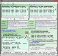
SEVENPAR (English)
SEVENPAR calculaties exact parameter sets for the Spatial Helmert or Molodensky Transformation with seven or three parameters, which are used for accurate geodetic datum shifts between different reference systems for coordinate transformations. Ключевые слова:
spatial, helmert, molodensky, molodenski, transformation
Скачать бесплатно! (2.48 Mb)
|
|
|
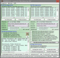
SEVENPAR Deutsch
SEVENPAR calculaties exact parameter sets for the Spatial Helmert or Molodensky Transformation with seven or three parameters, which are used for accurate geodetic datum shifts between different reference systems for coordinate transformations. Ключевые слова:
sevenpar, programm, helmert, 7Parameter, molodenski
Скачать бесплатно! (1.68 Mb)
|
|
|
?????»???????? 2012
«Полигон» - это уникальная программа для автоматизации межевания и отвода земель. Ключевые слова:
Range 2012, calculation of the geodata, scheduling of borders of the earths, input of coordinates
Скачать бесплатно! (3.3 Mb)
|
|
|
TOPOWIN English
TOPOWIN is a state-wide register of the German topographic cartographies and of localities with geo references in different coordinate systems. It also is a topographic information system. Ключевые слова:
geodetic, geodesic, functions, library, dll
Скачать бесплатно! (3.42 Mb)
|
|

|
CopanMobile for PocketPC
CopanMobile for PocketPC allows you to COGO (coordinate geometry), process field surveys, adjust map traverses, perform map/deed checks, calc curves and areas/perimeters, transform coords, interface with GPS, and import/export Ascii files. It's free. Ключевые слова:
free land survey software, free cogo software, free coordinate geometry software, coordinate geometry calculator, free GPS software
Скачать бесплатно! (341 Kb)
|
|

|
Copan for Mobile
Copan for Mobile allows you to COGO (do coordinate geometry), process field surveys, adjust map traverses, perform map/deed checks, calc curves and areas/perimeters, transform coords, interface with GPS, and import/export Ascii files. It's free. Ключевые слова:
free land survey software, free cogo software, free coordinate geometry software, coordinate geometry calculator, free GPS software
Скачать бесплатно! (364 Kb)
|
|

|
CopanMobile for PalmOS
Copan for PalmOS enables you to COGO (do coordinate geometry), process field surveys, adjust map traverses, perform map/deed checks, calc curves and areas/perimeters, transform coords, interface with GPS, and import/export Ascii files. It's free. Ключевые слова:
free land survey software, free cogo software, free coordinate geometry software, coordinate geometry calculator, field data processing
Скачать бесплатно! (341 Kb)
|
|
|
ORTWIN
ORTWIN is a program for the inquiry of localities in Germany. It finds postal zip codes, telephone pre selections, coordinates. It performs perimeter searches and distance calculations. It finds landscapes, natural units, snow- and wind load zones. Ключевые слова:
landschsft, naturraum, orte, ortschaften, plz
Скачать бесплатно! (4.36 Mb)
|
|

|
ORTWIN English
ORTWIN is a program for the inquiry of localities in Germany. It finds postal zip codes, telephone pre selections, coordinates. It performs perimeter searches and distance calculations. It finds landscapes, natural units, snow- and wind load zones. Ключевые слова:
natue, area, areas, landscape, landscapes
Скачать бесплатно! (3.7 Mb)
|
|

|
Copan for Windows
Copan for Windows enables you to calculate coordinate geometry (COGO), process field surveys, adjust map traverses, perform map/deed closure checks, calculate areas and perimeters, transform coordinates, and import/export Ascii files. It's free. Ключевые слова:
land survey software, cogo software, coordinate geometry software, coordinate geometry calculator, field data processing
Скачать бесплатно! (5.37 Mb)
|
|
Страница: 1
| 2
|
|
|
|