|
|
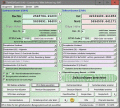
TRANSDAT (Deutsch)
TRANSDAT Coordinate Conversion supports thousands of coordinate systems and geodetic datum shifts, user-defined systems, INSPIRE, NTv2, BeTA2007, GPS, continental drift, many file systems, ESRI-Shape and much more with highest accuracy. Ключевые слова:
coordinate, coordinates, conversion, converter, convert
Скачать бесплатно! (3.58 Mb)
|
|

|
CopanMobile for PocketPC
CopanMobile for PocketPC allows you to COGO (coordinate geometry), process field surveys, adjust map traverses, perform map/deed checks, calc curves and areas/perimeters, transform coords, interface with GPS, and import/export Ascii files. It's free. Ключевые слова:
free land survey software, free cogo software, free coordinate geometry software, coordinate geometry calculator, free GPS software
Скачать бесплатно! (341 Kb)
|
|

|
Copan for Windows
Copan for Windows enables you to calculate coordinate geometry (COGO), process field surveys, adjust map traverses, perform map/deed closure checks, calculate areas and perimeters, transform coordinates, and import/export Ascii files. It's free. Ключевые слова:
land survey software, cogo software, coordinate geometry software, coordinate geometry calculator, field data processing
Скачать бесплатно! (5.37 Mb)
|
|

|
Copan for Mobile
Copan for Mobile allows you to COGO (do coordinate geometry), process field surveys, adjust map traverses, perform map/deed checks, calc curves and areas/perimeters, transform coords, interface with GPS, and import/export Ascii files. It's free. Ключевые слова:
free land survey software, free cogo software, free coordinate geometry software, coordinate geometry calculator, free GPS software
Скачать бесплатно! (364 Kb)
|
|

|
CopanMobile for PalmOS
Copan for PalmOS enables you to COGO (do coordinate geometry), process field surveys, adjust map traverses, perform map/deed checks, calc curves and areas/perimeters, transform coords, interface with GPS, and import/export Ascii files. It's free. Ключевые слова:
free land survey software, free cogo software, free coordinate geometry software, coordinate geometry calculator, field data processing
Скачать бесплатно! (341 Kb)
|
|
|
Fade One Image Into Another Software
Select two different images using this software and create a visual transformation from one picture to another. Save this transformation as a AVI or animated GIF file that can be viewed later. Ключевые слова:
transformation, morphing, morpher, fader, image changer
Скачать бесплатно! (1.32 Mb)
|
|

|
Plex.Earth Tools for AutoCAD
AutoCAD plug-in for advanced geographic interaction with Google Earth. Cover large areas with color imagery. Geo-locate site plans. Unique productivity tool with ???must-have??? features necessary for all engineers and architects. Ключевые слова:
AutoCAD, Google Earth, color images, imagery, coordinate systems
Скачать бесплатно! (1.6 Mb)
|
|
|
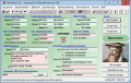
TOPOWIN English
TOPOWIN is a state-wide register of the German topographic cartographies and of localities with geo references in different coordinate systems. It also is a topographic information system. Ключевые слова:
geodetic, geodesic, functions, library, dll
Скачать бесплатно! (3.42 Mb)
|
|
|
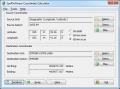
Eye4Software Coordinate Calculator
Eye4Software Coordinate Calculator is a very easy to use tool to perform gps coordinate conversions. Supported projections: Transverse Mercator, Lambert Conformal Conic, UTM, Gauss Kruger, Stereographic, Albers Equal Area, Oblique Mercator and more. Ключевые слова:
Coordinate Conversion, Coordinate Calculator, Convert Coordinates, GPS Coordinates Conversion, Map Datum Conversion
Скачать бесплатно! (8.96 Mb)
|
|

|
Advanced Points Manager
The Advanced points manager imports points to AutoCAD drawing from different data sources. OLE-DB Database, SHP (ESRI shape file), GPX (GPS eXchange format), KML (Keyhole Markup Language), GML (Geography Markup Language), TXT, CSV. Ключевые слова:
AutoCAD, import points, TXT file, SHP file, OLE-DB compliant database
Скачать бесплатно! (609 Kb)
|
|
Страница: 1
| 2 | 3
| 4
| 5
|
|
|
|