|
|
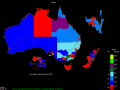
OzGIS
OzGIS is an extensive system for the analysis and display of geographically referenced data. The system can be used to analyze socio-economic and demographic data produced by censuses and surveys and to support management decisions. Ключевые слова:
mapping, census, territory, GIS
Скачать бесплатно! (313 Kb)
|
|
|
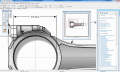
Vextractor x64
Vextractor - это инструмент для преобразования растровых изображений в векторные. Поддерживает множество рапространенных растровых и векторных форматов. Может преобразовывать фото, чертежи, схемы, карты, логотипы и т.п. Ключевые слова:
raster to vector, image to vector, raster, vector, vectorise
Скачать бесплатно! (3.99 Mb)
|
|

|
ROAD-MAPPING-SOFTWARE
ROAD-MAPPING Software Strategy Framework Model, Strategic Management, MBA models and frameworks, business Ключевые слова:
ROAD-MAPPING Software, Analysis, Strategy, MBA, Framework
Скачать бесплатно! (11.9 Mb)
|
|

|
TABULA FacadeSignage Video Mapping
FacadeSignage is a novel Digital Signage solution: the easiest projection mapping software on the market. Use a PC and one (or more) projectors to dress any physical object or architectural structure with digital media. Ключевые слова:
digital signage, projection mapping, video mapping
Скачать бесплатно! (32 Mb)
|
|
|
MindView
MindView is a professional mind mapping software that allows you to visually brainstorm, organize and present ideas. With powerful MS Office integration, project management features and collaboration options, MindView has become the industry leader. Ключевые слова:
Matchware, MindView, Mind Map, Mind Mapping, Mind Mapping software
Скачать бесплатно! (712.53 Mb)
|
|
|
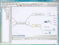
Visual Mind
Visual Mind is 'mind mapping' software that improves your thinking and information management. It is brilliant for storing and organizing information, thoughts, ideas, and knowledge. Perfect if you feel you 'juggle to many balls' at the same time. Ключевые слова:
Mind Mapping, Planning, Organizing, Outlining, Brainstorming
Скачать бесплатно! (32 Mb)
|
|
|
ACDSee Canvas 12 with GIS+
Canvas is the integrated application that accelerates your technical illustration workflow. Professionals in high tech environments that require accurate visualization of technical data rely on Canvas to collaborate and improve productivity. Ключевые слова:
Technical illustration, CAD, 3D, precision drawing, aerospace
Скачать бесплатно! (32 Mb)
|
|

|
Map View SDK
The Map View SDK is available as a stand alone Developer kit. The Map View SDK offers a Direct DLL method to draw multi-type maps by region within your application. Ключевые слова:
GIS, Google Maps, Map View, SDK, Satelite Map
Скачать бесплатно! (1.12 Mb)
|
|

|
Icons-Land POI Vector Icons
POI Vector Icons can be used in Tourism and Entertainment industries, as it joins points of interest icons such as Gas Station, Restaurant, Bank, Hospital, etc. All icons are provided in AI (Adobe Illustrator) format in different color variations. Ключевые слова:
Vector Icons, Vista Icons, POI, POI Icons, Points Of Interest Icons
Скачать бесплатно! (1.48 Mb)
|
|

|
BUSINESS-MIND-MAPPING-SOFTWARE
BUSINESS-MIND-MAPPING Software Strategy Framework Model, Strategic Management, MBA models and frameworks, business Ключевые слова:
BUSINESS-MIND-MAPPING Software, Analysis, Strategy, MBA, Framework
Скачать бесплатно! (11.9 Mb)
|
|
Страница: 1
| 2
| 3 | 4
| 5
|
|
|
|