|
|
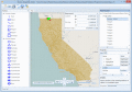
Manco Shapefile Editor
Manco Shapefile Editor is a powerful tool for creating and editing shapefiles. Edit geometry of shapes easily. Add multiple images and enable an OpenStreetMap provider. Edit all the layers data at any time. Export your images to the shapefiles. Ключевые слова:
ESRI, shape, file, KML, editor
Скачать бесплатно! (6.14 Mb)
|
|

|
Map Export
Map Export is a GIS developer oriented tool for downloading and exporting background image. Map Export can export both satellite imagery and street maps from Google Map. It can export in many kinds of bmp format as you like. Ключевые слова:
GIS, Google Maps, map export, browser, satelite
Скачать бесплатно! (2.35 Mb)
|
|
|
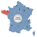
Click-and-Drag Map of France
Click-and-Drag Map of France for websites with wysiwyg editor tool. Add pinpoints on a map! Features: - Color, URL linking, captions and more; - Intuitive Flash Map Interface; - Ease of Use; - Customizations via XML; www.fla-shop.com Ключевые слова:
USA, wysiwyg, tool, UK, United
Скачать бесплатно! (346 Kb)
|
|

|
Maps Package
There are very easy to customize via XML. You don't need to know Flash. The maps are 100% vectorial graphic. Get 20 maps at the price of 6. This package contains: XML Canada Map, XML USA Map, XML Central America, XML South America, XML Europe Map, XM Ключевые слова:
flash components, actionscript, video player, audio, flash galleries
Скачать бесплатно! (100 Kb)
|
|
|
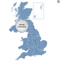
Click-and-Drag Map of UK regions
Click-and-Drag Map of UK for websites with wysiwyg editor tool. Add pinpoints on a map! Features: - Color, URL linking, captions and more; - Intuitive Flash Map Interface; - Ease of Use; - Customizations via XML; www.fla-shop.com Ключевые слова:
USA, wysiwyg, tool, UK, United
Скачать бесплатно! (400 Kb)
|
|
|
Region Map Generator
a tool to make region map with self-definition color. The original maps in the software are blank political region ones for different countries or areas. You can color any region with whatever color as you like. Ключевые слова:
Region Map, Sales Map
Скачать бесплатно! (3.5 Mb)
|
|

|
Map View
Map View is a professional map browser. Both satellite imagery and maps online can be viewed through it. With the cache technology, it improve the user experience of viewing map. Ключевые слова:
Google Maps, map viewer, browser, satelite, map
Скачать бесплатно! (1.92 Mb)
|
|
|
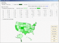
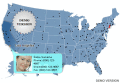
Zoom Map of USA
Interactive Zoomable Map of USA with Clickable Cities for Websites and Web Developers. Features: Color, URL linking, captions and more; - Intuitive Flash Map Interface; - Ease of Use; - Customizations via an XML file; Wysiwyg Editor. www.fla-shop.com Ключевые слова:
USA, states, map, locator, zoom
Скачать бесплатно! (284 Kb)
|
|
|
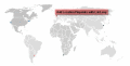
Interactive Flash World Map
An elegant interactive flash map of the world. This interactive world map includes 165 clickable countries. Display country statistics, country-specific information or mark pinpoint locations. The map uses XML and is easy to customize or install. Ключевые слова:
Flash world map, interactive maps flash, world interactive map, map of the world, XML
Скачать бесплатно! (864 Kb)
|
|

|
Flash for Google Maps DW Extension
Flash Google Maps for Adobe Dreamweaver! Ключевые слова:
Google Maps, Flash Google maps for web, dreamweaver extensions, Google Maps for dreamweaver, google flash component
Скачать бесплатно! (827 Kb)
|
|
Страница: 1
| 2 | 3
| 4
| 5
|
|
|
|