|
|
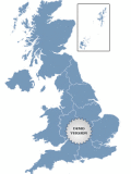
Golden UK Map
Golden UK Map. Special visual effect. Features: - Color, URL linking, captions and more; - Intuitive Flash Map Interface; - Ease of Use; - Customizations via an XML file; www.fla-shop.com Ключевые слова:
Golden, UK, Map, states, flash
Скачать бесплатно! (341 Kb)
|
|
|
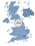
Postcode Map of UK
Postcode Map of UK. Features: - Color, URL linking, captions and more; - Intuitive Flash Map Interface; - Ease of Use; - Customizations via an XML file; www.fla-shop.com Ключевые слова:
Postcode, Map, UK, states, flash
Скачать бесплатно! (162 Kb)
|
|

|
US County Zoom Map
A cool-looking Flash map of the U.S. with all counties. This zoom map features high customization capabilities via a simple XML file. Texts, fonts, colors, popups messages and links are all adjustable. Ключевые слова:
flash, interactive, usa, united, counties
Скачать бесплатно! (417 Kb)
|
|
|
MindOnMap for Mac
MindOnMap для Mac вдохновлен моделями мышления человеческого мозга. Он служит мощным инструментом для визуализации и организации мыслей и помогает вам эффективно и интуитивно собирать идеи. Ключевые слова:
mind map maker, draw ideas, idea map
Скачать бесплатно! (90.57 Mb)
|
|
|
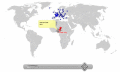
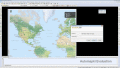
Pinpoint Locator Map of World
Pinpoint Locator Map of World for websites with wysiwyg editor tool. New release! Features: - Color, URL linking, captions and more; - Intuitive Flash Map Interface; - Ease of Use; - Customizations via an XML file Ключевые слова:
Zoom, World, Map, flash map, interactive maps
Скачать бесплатно! (528 Kb)
|
|
|
Automapki
Automapki application brings web mapping to AutoCAD / ZWCAD / BricsCAD to display your project on top of your favourite web mapping source: either Open Street Map, Map Quest, Open Aerial, or any user defined WMS base layer. Ключевые слова:
autocad, gis, web map, mapguide, satellite imagery
Скачать бесплатно! (32 Mb)
|
|

|
Automapki x64
Automapki application brings web mapping to AutoCAD / ZWCAD / BricsCAD to display your project on top of your favourite web mapping source: either Open Street Map, Map Quest, Open Aerial, or any user defined WMS base layer. Ключевые слова:
autocad, gis, web map, mapguide, satellite imagery
Скачать бесплатно! (32 Mb)
|
|
|
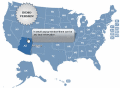
US and Counties Map Locator
United States and Counties Map Locator. The map contains locator maps of each state! Features: - Color, URL linking, captions and more; - Intuitive Flash Map Interface; - Ease of Use; - Customizations via an XML file; www.fla-shop.com Ключевые слова:
USA, US, states, flash, map
Скачать бесплатно! (750 Kb)
|
|

|
MLC Usa Map Puzzle
Solve this challenging USA Map Puzzle and have fun. Ключевые слова:
puzzle, game, usa map
Скачать бесплатно! (341 Kb)
|
|

|
CoffeeCup Image Mapper
CoffeeCup Image Mapper allows you to specify multiple links (or hotspots) to specific locations of an image and point them to a document or website. Create mouseover text, ALT text, links and more. Supports JPG, PNG, and GIF image formats! Ключевые слова:
image map, gif, jpg, images, link
Скачать бесплатно! (3.37 Mb)
|
|
Страница: 1
| 2
| 3
| 4 | 5
|
|
|
|