|

|
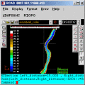
RTOPO
Simple, powerful and inexpensive CAD software for surveying. You can do triangulation, isolines, color-filled contour maps, sections, intersections, volume and editing XYZ files. You can process hundreds of thousands of points or triangles. Ключевые слова:
CAD for Topography, XYZ File editor, LandXML, Triangulation, Isolines
Скачать бесплатно! (1.04 Mb)
|
|
|
RTOPO Hydrology
Simple, powerful and inexpensive CAD software for surveying. You can do triangulation, isolines, color-filled contour maps, sections, intersections, volume, simulation of rainwater runoff and editing XYZ files. Ключевые слова:
CAD for Topography, XYZ File editor, hydrology, LandXML, Triangulation
Скачать бесплатно! (2.48 Mb)
|
|

|
OkMap
OkMap is a software that works with vectorial and raster maps that you have bought or scanned. OkMap lets you organize paths by creating waypoints, routes and tracks, and upload/download data to/from your GPS. OkMap supports GPS real-time navigation. Ключевые слова:
gps software, map software, cartographic software, poi, waypoint
Скачать бесплатно! (20.21 Mb)
|
|
Страница: 1
| 2
| 3
| 4
| 5
|
|
|
|