|

|
Euro Truck Simulator 2
Добро пожаловать в Euro Truck Simulator 2! Наконец-то у Вас появилась возможность почувствовать себя в шкуре водителя-дальнобойщика! Удачи! Ключевые слова:
euro truck simulator, truck sim, truck game, driving game, driving simulation
Скачать бесплатно! (32 Mb)
|
|
|
MPMileage
Batch calculate distances, travel times, and/or costs for point-to-point routes listed in a database (Access, Excel, or ODBC). Uses MapPoint for point locations and route calculations. Supports all of MapPoint's route options. Ключевые слова:
mileage, distance, routes, route costs, route list
Скачать бесплатно! (2.71 Mb)
|
|
|
MileCharter
Calculate Mileage Charts and Tables with Microsoft MapPoint. Calc. tables for customers and suppliers incl. "closest only", or to create "road atlas" tables. Output Distances, travel times and/or estimated costs to Excel. Supports ALL route options. Ключевые слова:
mileage charts, table, route costs, mapping distances, travel-times
Скачать бесплатно! (3.65 Mb)
|
|
|
Loop the City
Construct a road that loops around the city. Ключевые слова:
block, branch, building, city, edge
Скачать бесплатно! (293 Kb)
|
|
|
Auto Road
Auto Road is a road quantity estimation software which automates the drawing and calculations of roads constructions works and is widely used for roads construction planning works. Ключевые слова:
AutoRoad, Road Estimation Software
Скачать бесплатно! (10.77 Mb)
|
|

|
Mileage Charts for Europe
European Mileage Charts and Tables stored as Excel 2007 workbooks, including travel times and distances for both the fastest and shortest routes. Includes two pan-European table; plus tables for 24 European countries. Ключевые слова:
mileage charts, mileage tables, travel time, road distances, cities
Скачать бесплатно! (32 Mb)
|
|

|
KLONK Map Measurement
KLONK Map Measurement uses lines and shapes to check one or several distances and estimate sizes of different features on Earth. With Map Measurement, you can measure the length on the ground with a line or polygon. Ключевые слова:
map, measurement, area, length, distance
Скачать бесплатно! (32 Mb)
|
|

|
Mileage Charts for North America
North American Mileage Charts and Tables stored as Excel 2007 workbooks, including travel times and distances for both the fastest and shortest routes. Includes a table for N.America; plus tables for every US State and Canadian Territory. Ключевые слова:
mileage charts, mileage tables, travel time, road distances, cities
Скачать бесплатно! (32 Mb)
|
|

|
Animal Ambush
You've decided to take a nice, relaxing drive in the country. Unfortunately, you picked the wrong road to travel on. There are no other cars on the road, but there are many animals running across the road! Avoid the animals and get home safely! Ключевые слова:
car, driving, animals, pc game
Скачать бесплатно! (14.29 Mb)
|
|
|
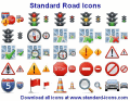
Standard Road Icons
Create online and printed matters of road infrastructure. Standard Road Icons are professionally drawn and come in a variety of sizes and resolutions to compliment your project. Ключевые слова:
icons, icon set, road icons, road signs, lumina icons
Скачать бесплатно! (1.01 Mb)
|
|
Страница: 1 | 2
| 3
| 4
| 5
|
|
|
|