|
|
SEVENPAR English
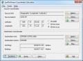
SEVENPAR calculaties exact parameter sets for the Spatial Helmert or Molodensky Transformation with seven or three parameters, which are used for accurate geodetic datum shifts between different reference systems for coordinate transformations. Ключевые слова:
geodetic, program, terminal, service, citrix
Скачать бесплатно! (1.66 Mb)
|
|
|
Eye4Software Coordinate Calculator
Eye4Software Coordinate Calculator is a very easy to use tool to perform gps coordinate conversions. Supported projections: Transverse Mercator, Lambert Conformal Conic, UTM, Gauss Kruger, Stereographic, Albers Equal Area, Oblique Mercator and more. Ключевые слова:
Coordinate Conversion, Coordinate Calculator, Convert Coordinates, GPS Coordinates Conversion, Map Datum Conversion
Скачать бесплатно! (8.96 Mb)
|
|
|
WinDraw
This software utility can plot regular or parametric functions, in Cartesian or polar coordinate systems, and is capable to evaluate the roots, minimum and maximum points as well as the first derivative and the integral value of regular functions. Ключевые слова:
function, graph, plot, parametric, polar
Скачать бесплатно! (1.18 Mb)
|
|
|
TOPOWIN English
TOPOWIN is a state-wide register of the German topographic cartographies and of localities with geo references in different coordinate systems. It also is a topographic information system. Ключевые слова:
geodetic, geodesic, functions, library, dll
Скачать бесплатно! (3.42 Mb)
|
|
|
CopanMobile for PocketPC
CopanMobile for PocketPC allows you to COGO (coordinate geometry), process field surveys, adjust map traverses, perform map/deed checks, calc curves and areas/perimeters, transform coords, interface with GPS, and import/export Ascii files. It's free. Ключевые слова:
free land survey software, free cogo software, free coordinate geometry software, coordinate geometry calculator, free GPS software
Скачать бесплатно! (341 Kb)
|
|
|
Copan for Mobile
Copan for Mobile allows you to COGO (do coordinate geometry), process field surveys, adjust map traverses, perform map/deed checks, calc curves and areas/perimeters, transform coords, interface with GPS, and import/export Ascii files. It's free. Ключевые слова:
free land survey software, free cogo software, free coordinate geometry software, coordinate geometry calculator, free GPS software
Скачать бесплатно! (364 Kb)
|
|
|
CopanMobile for PalmOS
Copan for PalmOS enables you to COGO (do coordinate geometry), process field surveys, adjust map traverses, perform map/deed checks, calc curves and areas/perimeters, transform coords, interface with GPS, and import/export Ascii files. It's free. Ключевые слова:
free land survey software, free cogo software, free coordinate geometry software, coordinate geometry calculator, field data processing
Скачать бесплатно! (341 Kb)
|
|
|
BetaDLL
BetaDLL contains precise functions for coordinate transformations and datum shifts using the German NTv2 standard BeTA2007. The Functions of the 32 bit / 64 bit DLL can be easy called from own applications. Ключевые слова:
ntv2, beta2007, betadll, killetsoft
Скачать бесплатно! (1020 Kb)
|
|
|
TOPOWIN
TOPOWIN is a state-wide register of the German topographic cartographies and of localities with geo references in different coordinate systems. It also is a topographic information system. Ключевые слова:
geodauml, tisch, funktionen, library, dll
Скачать бесплатно! (4.06 Mb)
|
|
|
Copan for Windows
Copan for Windows enables you to calculate coordinate geometry (COGO), process field surveys, adjust map traverses, perform map/deed closure checks, calculate areas and perimeters, transform coordinates, and import/export Ascii files. It's free. Ключевые слова:
land survey software, cogo software, coordinate geometry software, coordinate geometry calculator, field data processing
Скачать бесплатно! (5.37 Mb)
|
|
Страница: 1
| 2 | 3
| 4
| 5
|
|
|
|