|

|
BetaDLL
BetaDLL contains precise functions for coordinate transformations and datum shifts using the German NTv2 standard BeTA2007. The Functions of the 32 bit / 64 bit DLL can be easy called from own applications. Ключевые слова:
ntv2, beta2007, betadll, killetsoft
Скачать бесплатно! (1020 Kb)
|
|

|
TRANSDAT
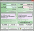
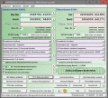
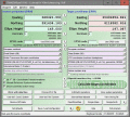
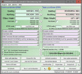
TRANSDAT Coordinate Conversion supports thousands of coordinate systems and geodetic datum shifts, user-defined systems, INSPIRE, NTv2, BeTA2007, GPS, continental drift, Shape, KML, CSV and other file systems and much more with highest accuracy. Ключевые слова:
NTv2, coordinate transformation, reference system, grid file, polygonal area
Скачать бесплатно! (4.42 Mb)
|
|

|
TRANSDAT (Deutsch)
TRANSDAT Coordinate Conversion supports thousands of coordinate systems and geodetic datum shifts, user-defined systems, INSPIRE, NTv2, BeTA2007, GPS, continental drift, many file systems, ESRI-Shape and much more with highest accuracy. Ключевые слова:
coordinate, coordinates, conversion, converter, convert
Скачать бесплатно! (3.58 Mb)
|
|

|
GeoDLL
GeoDLL supports the development of geodetic software on various platforms by providing geodetic functions. GeoDLL contains precise calculations on the themes 2D and 3D coordinate transformation, geodetic datum shift and reference system and more. Ключевые слова:
NTv2, coordinate, transformation, reference, system
Скачать бесплатно! (4.41 Mb)
|
|

|
TRANSDAT (English)
TRANSDAT Coordinate Conversion supports thousands of coordinate systems and geodetic datum shifts, user-defined systems, INSPIRE, NTv2, BeTA2007, GPS, continental drift, Shape, KML, CSV and other file systems and much more with highest accuracy. Ключевые слова:
coordinate, coordinates, conversion, converter, convert
Скачать бесплатно! (2.49 Mb)
|
|

|
TRANSDAT English
TRANSDAT Coordinate Conversion supports thousands of coordinate systems and geodetic datum shifts, user-defined systems, INSPIRE, NTv2, BeTA2007, GPS, continental drift, Shape, KML, CSV and other file systems and much more with highest accuracy. Ключевые слова:
transdat, wgs84, etrs89, gps, coordinate transformation
Скачать бесплатно! (2.91 Mb)
|
|

|
GeoDLL English
GeoDLL supports the development of geodetic software on various platforms by providing geodetic functions. GeoDLL contains precise calculations on the themes 2D and 3D coordinate transformation, geodetic datum shift and reference system and more. Ключевые слова:
helmert, molodenski, parameter, seven, spatial
Скачать бесплатно! (2.58 Mb)
|
|

|
GeoDLL Deutsch
GeoDLL supports the development of geodetic software on various platforms by providing geodetic functions. GeoDLL contains precise calculations on the themes 2D and 3D coordinate transformation, geodetic datum shift and reference system and more. Ключевые слова:
helmert, molodenski, transformationsparameter, sieben, parameter
Скачать бесплатно! (2.58 Mb)
|
|

|
Eye4Software Coordinate Calculator
Eye4Software Coordinate Calculator is a very easy to use tool to perform gps coordinate conversions. Supported projections: Transverse Mercator, Lambert Conformal Conic, UTM, Gauss Kruger, Stereographic, Albers Equal Area, Oblique Mercator and more. Ключевые слова:
Coordinate Conversion, Coordinate Calculator, Convert Coordinates, GPS Coordinates Conversion, Map Datum Conversion
Скачать бесплатно! (8.96 Mb)
|
|

|
Eye4Software Hydromagic
Hydrographic Survey Software for Windows, Load topographic or nautical maps, create singlebeam soundings, generate DTM's (Digital Terrain Models), generate depth contours, generate cross-sections, volume calculations and more. Ключевые слова:
Hydrographic Survey Software, Hydrographic Software, Hydrographic Survey, Bathymetry, Seafloor Mapping Software
Скачать бесплатно! (32 Mb)
|
|
Страница: 1
|
|
|
|
