|

|
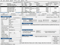
Cruiser Geo2IP
Cruiser Geo2IP is a worldwide Geo2IP Database and information query program. It is a powerful tool which allows users to search geography information to IP range segments and query IP/IP Range to geography information. Ключевые слова:
Geo2IP, IP Database, Geo2IP database, Cruiser Geo2IP, Geography to IP
Скачать бесплатно! (2.8 Mb)
|
|

|
USA Real Estate Map Pro
With Real Estate Pro you can visualize your data, shade regions, see 51 states of the USA on the National View, use advanced search, add cities or custom locations according to their latitude/longitude, zoom search results on the map. Ключевые слова:
USA Real Estate Map Pro, flash map, real estate maps, interactive real estate map, usa real estate maps
Скачать бесплатно! (10.42 Mb)
|
|
|
TATEMS Fleet Maintenance Software
TATEMS 20/20 Fleet Maintenance Software Program has been Making Life Easier For Fleet Managers because they have FINALLY DISCOVERED a system that is SO SIMPLE and SO EASY TO USE ... Ключевые слова:
Fleet Maintenance Software, Fleet Management Software, Fleet Maintenance Program, , Maintenance Software
Скачать бесплатно! (32 Mb)
|
|

|
AnyChart Flash Map Component
Anychart Flash Maps Flexible XML-Driven solution: US, World, US Counties. You can add background and captions, XML data file and a set of customizable options make AnyChart Maps a universal solution for web developers. Ключевые слова:
AnyChart, Chart, Macromedia, Flash, flashmaps
Скачать бесплатно! (2.77 Mb)
|
|
|
Geodaten Deutschland
The database contain geodata of the Federal Republic of Germany with geo referenced towns, municipalities, town quarters, administrative units, postal codes, telephone preselections, nature areas, landscapes, climatic zones for proximity searches ec. Ключевые слова:
geodaten, koordinaten, umkreissuche, naturr?¤umliche, gliederung
Скачать бесплатно! (1.79 Mb)
|
|

|
Geo Data German Admin
The database contain geodata of the Federal Republic of Germany with geo referenced towns, municipalities, town quarters, administrative units, postal codes, telephone preselections, nature areas, landscapes, climatic zones for proximity searches ec. Ключевые слова:
geo, data, geodata, coordinate, coordinates
Скачать бесплатно! (1.93 Mb)
|
|

|
Graph Earth
Visualize your data in 3D! Quick, easy and inexpensive. Graph Earth enables business professionals to create stunning visual representations of their data, all without the time and costs associated with a full-feature GIS. Ключевые слова:
google earth, kml, kmz, map, 3d graph
Скачать бесплатно! (469 Kb)
|
|
|
Geodata Germany
The database contain geodata of the Federal Republic of Germany with geo referenced towns, municipalities, town quarters, administrative units, postal codes, telephone preselections, nature areas, landscapes, climatic zones for proximity searches ec. Ключевые слова:
geo, data, geodata, coordinate, coordinates
Скачать бесплатно! (3.05 Mb)
|
|
Страница: 1
| 2
| 3
| 4
|
|
|
|