Скачать свежий бесплатный софт
esri
Мультимедия :: Редакторы Изображений
Дом и Обучение :: Математика
Инструменты Разработчика :: Компоненты и Библиотеки
Creating and editing ESRI shape and KML files.

Manco Shapefile Editor


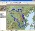
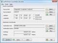
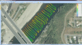
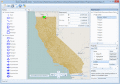
Manco Shapefile Editor is a powerful tool for creating and editing shapefiles. Edit geometry of shapes easily. Add multiple images and enable an OpenStreetMap provider. Edit all the layers data at any time. Export your images to the shapefiles.

Ключевые слова:
ESRI, shape, file, KML, editor

Скачать бесплатно! (5.33 Mb)


Shape manipulation tool for MS MapPoint

MPSuperShape


MPSuperShape is a shape manipulation tool for Microsoft MapPoint. MPSuperShape can combine shapes, find overlaps, find boundaries, and import/export various files. MapPoint 2006, .NET Framework 2.0 (or later), and Windows XP or Vista required.

Ключевые слова:
MapPoint, shapes, GIS, union, intersection

Скачать бесплатно! (13.54 Mb)


Image and vectordata viewing and processing

THBImage


Full featured and affordable image and vectordata viewing and processing for
ActiveX,.NET,C#,VB.NET,VB,C++,DLL,LIB at your fingertips. Scrolling, Zooming, Panning. Supports all common fileformats: TIFF, PDF, JBIG2, JPEG2000, DXF, DGN, ESRI SHP

Ключевые слова:
image processing, vector processing, dxf, shape, shp

Скачать бесплатно! (23.84 Mb)


Map Export is a GIS developer oriented tool.

Map Export


Map Export is a GIS developer oriented tool for downloading and exporting background image. Map Export can export both satellite imagery and street maps from Google Map. It can export in many kinds of bmp format as you like.

Ключевые слова:
GIS, Google Maps, map export, browser, satelite

Скачать бесплатно! (2.35 Mb)


Eye4Software Coordinate Calculator

Eye4Software Coordinate Calculator


Eye4Software Coordinate Calculator is a very easy to use tool to perform gps coordinate conversions. Supported projections: Transverse Mercator, Lambert Conformal Conic, UTM, Gauss Kruger, Stereographic, Albers Equal Area, Oblique Mercator and more.

Ключевые слова:
Coordinate Conversion, Coordinate Calculator, Convert Coordinates, GPS Coordinates Conversion, Map Datum Conversion

Скачать бесплатно! (8.96 Mb)


A suite of advanced .NET WinForms controls.

MindFusion WinForms Pack


MindFusion WinForms provides advanced flow diagramming, reporting, charting and scheduling components that can be easily integrated into any .NET WinForms application. The features provided range from editing of schedules and diagrams to PDF export.

Ключевые слова:
.NET, WinForms, Windows Forms, control, component

Скачать бесплатно! (32 Mb)


Chart and diagram suite for .NET

Nevron Vision for .NET


.NET Vision is a professional suite for creating state-of-art data presentation and map applications with spectacular data visualization capabilities. It delivers powerful Charting and Diagramming components for Windows Forms and ASP.NET.

Ключевые слова:
.net diagram, .net chart, block diagram, map diagrams, ESRI import

Скачать бесплатно! (32 Mb)


TRANSDAT - Coordinate conversion

TRANSDAT (Deutsch)


TRANSDAT Coordinate Conversion supports thousands of coordinate systems and geodetic datum shifts, user-defined systems, INSPIRE, NTv2, BeTA2007, GPS, continental drift, many file systems, ESRI-Shape and much more with highest accuracy.

Ключевые слова:
coordinate, coordinates, conversion, converter, convert

Скачать бесплатно! (3.58 Mb)


Hydrographic Survey Software for Windows

Eye4Software Hydromagic


Hydrographic Survey Software for Windows, Load topographic or nautical maps, create singlebeam soundings, generate DTM's (Digital Terrain Models), generate depth contours, generate cross-sections, volume calculations and more.

Ключевые слова:
Hydrographic Survey Software, Hydrographic Software, Hydrographic Survey, Bathymetry, Seafloor Mapping Software

Скачать бесплатно! (32 Mb)


A free  GIS/CAD/Map viewer.

AvisMap Free Viewer


The free AvisMap Viewer opens most GIS/CAD and raster image file types and most ArcView, ArcExplorer, and MapInfo projects. Besides just opening and viewing files, the Viewer supports an extensive list of features.

Ключевые слова:
GIS mapping software, maps, mapping, GIS, GIS SDK

Скачать бесплатно! (22.28 Mb)


Страница: 1 | 2 | 3
Категории:
Свежий софт:
Наши проекты: