|
|
Yahoo Satellite Maps Downloader
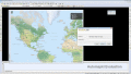
Yahoo Satellite Maps Downloader is a cute tool that can automatically download Yahoo satellite maps small tile map images and then combine them into one big map image. It supports multithreads, so the download speed is very fast. Ключевые слова:
Yahoo maps, Yahoo satellite maps, satellite maps, download
Скачать бесплатно! (953 Kb)
|
|
|
Microsoft VirtualEarth Satellite Downloader
It is a cute tool that help you to get small tile satellite images from Microsoft VirtualEarth. All downloaded small images are saved on the disk. You can view downloaded maps by Map Viewer Or you can combine them. Ключевые слова:
Microsoft, satellite, maps, download
Скачать бесплатно! (1.19 Mb)
|
|
|
Easy Ovi Maps Downloader
Easy Ovi Maps Downloader is a tool that help you to get small tile images from Ovi maps. You can view downloaded maps by Maps Viewer Or you can combine them into a big BMP map by Maps Combiner. Ключевые слова:
Ovi maps, Nokia maps, satellite image, satellite map, download
Скачать бесплатно! (1.27 Mb)
|
|
|
Easy Google Maps Downloader
Easy Google Maps Downloader is a tool that help you to get small tile images from Google maps. You can view downloaded maps by Maps Viewer Or you can combine them into a big BMP map by Maps Combiner. Ключевые слова:
Google maps, satellite image, satellite map, download
Скачать бесплатно! (1.26 Mb)
|
|
|
Easy Yahoo Maps Downloader
Easy Yahoo Maps Downloader is a tool that help you to get small tile images from Yahoo maps. You can view downloaded maps by Maps Viewer Or you can combine them into a big BMP map by Maps Combiner. Ключевые слова:
Yahoo maps, satellite image, satellite map, download
Скачать бесплатно! (1.27 Mb)
|
|
|
Automapki
Automapki application brings web mapping to AutoCAD / ZWCAD / BricsCAD to display your project on top of your favourite web mapping source: either Open Street Map, Map Quest, Open Aerial, or any user defined WMS base layer. Ключевые слова:
autocad, gis, web map, mapguide, satellite imagery
Скачать бесплатно! (32 Mb)
|
|
|
Automapki x64
Automapki application brings web mapping to AutoCAD / ZWCAD / BricsCAD to display your project on top of your favourite web mapping source: either Open Street Map, Map Quest, Open Aerial, or any user defined WMS base layer. Ключевые слова:
autocad, gis, web map, mapguide, satellite imagery
Скачать бесплатно! (32 Mb)
|
|
|
Map Export
Map Export is a GIS developer oriented tool for downloading and exporting background image. Map Export can export both satellite imagery and street maps from Google Map. It can export in many kinds of bmp format as you like. Ключевые слова:
GIS, Google Maps, map export, browser, satelite
Скачать бесплатно! (2.35 Mb)
|
|
|
Transnavicom Satellite Map of Zurich
Демо-версия «Спутниковой карты Цюриха»! Новейшие разработки и передовой опыт компании «Транснавиком» дают возможность создавать такие высококачественные и уникальные продукты! Спутниковые технологии доступны каждому! Ключевые слова:
electronic map, Zurich, satellite map
Скачать бесплатно! (18.76 Mb)
|
|
|
Map View
Map View is a professional map browser. Both satellite imagery and maps online can be viewed through it. With the cache technology, it improve the user experience of viewing map. Ключевые слова:
Google Maps, map viewer, browser, satelite, map
Скачать бесплатно! (1.92 Mb)
|
|
Страница: 1 | 2
| 3
| 4
| 5
|
|
|
|