|
|
Webcam Surveyor
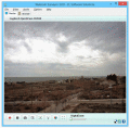
Webcam Surveyor - Программа для видеонаблюдения и видеозаписи. Ключевые функции: Запись видео со звуком, захват последовательности изображений, детектор движений, motion capture, FTP оповещение, скрытый режим, защита паролем и т.д. Ключевые слова:
webcam surveyor, webcam, software, soft, web cam
Скачать бесплатно! (3.05 Mb)
|
|
|
Claim management system
Vehicle Survey Software, Survey valuation system, claim management system, small vehicle valuator, claim automation system Ключевые слова:
Insurance Surveyor, loss assessor App
Скачать бесплатно! (8.4 Mb)
|
|
|
CopanMobile for PocketPC
CopanMobile for PocketPC allows you to COGO (coordinate geometry), process field surveys, adjust map traverses, perform map/deed checks, calc curves and areas/perimeters, transform coords, interface with GPS, and import/export Ascii files. It's free. Ключевые слова:
free land survey software, free cogo software, free coordinate geometry software, coordinate geometry calculator, free GPS software
Скачать бесплатно! (341 Kb)
|
|
|
Copan for Mobile
Copan for Mobile allows you to COGO (do coordinate geometry), process field surveys, adjust map traverses, perform map/deed checks, calc curves and areas/perimeters, transform coords, interface with GPS, and import/export Ascii files. It's free. Ключевые слова:
free land survey software, free cogo software, free coordinate geometry software, coordinate geometry calculator, free GPS software
Скачать бесплатно! (364 Kb)
|
|
|
CopanMobile for PalmOS
Copan for PalmOS enables you to COGO (do coordinate geometry), process field surveys, adjust map traverses, perform map/deed checks, calc curves and areas/perimeters, transform coords, interface with GPS, and import/export Ascii files. It's free. Ключевые слова:
free land survey software, free cogo software, free coordinate geometry software, coordinate geometry calculator, field data processing
Скачать бесплатно! (341 Kb)
|
|
|
Copan for Windows
Copan for Windows enables you to calculate coordinate geometry (COGO), process field surveys, adjust map traverses, perform map/deed closure checks, calculate areas and perimeters, transform coordinates, and import/export Ascii files. It's free. Ключевые слова:
land survey software, cogo software, coordinate geometry software, coordinate geometry calculator, field data processing
Скачать бесплатно! (5.37 Mb)
|
|
Страница: 1
|
|
|
|