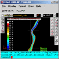
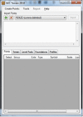
Скачать свежий бесплатный софт
triangulation
c triangulation
Мультимедия :: 3D Моделирование и CAD
Бизнес :: Прочее
Бизнес :: Управление Проектами
TRIANGULATION,ISOLINES,VOLUME,3DINTERSECTION

TRIANGULATION for IntelliCAD


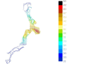
TRIANGULATION, ISOLINES, VOLUME, LOADING of XYZ points files, 3DINTERSECTION and sections, color-filled contour map ; 7 functions for IntelliCAD versions which can load SDS applications (dll).

Ключевые слова:
TRIANGULATION, ISOLINES, VOLUME, 3D, INTERSECTION

Скачать бесплатно! (587 Kb)


Triangulation+Isolines+KML for AUTOCAD.

TRIANGULATION for AutoCAD


An add-on for AUTOCAD, for the TRIANGULATION of a set of point, isolines, KML creator, the VOLUME of a set of 3dface entities, loading of XYZ points files and sections.

Ключевые слова:
AutoCAD Add-ons, Topography, KML creator, XYZ File, LandXML

Скачать бесплатно! (648 Kb)


Edit XYZ files; triangulation and isolines.

RTOPO


Simple, powerful and inexpensive CAD software for surveying. You can do triangulation, isolines, color-filled contour maps, sections, intersections, volume and editing XYZ files. You can process hundreds of thousands of points or triangles.

Ключевые слова:
CAD for Topography, XYZ File editor, LandXML, Triangulation, Isolines

Скачать бесплатно! (1.04 Mb)


Edit XYZ files; triangulation and isolines.

RTOPO Hydrology


Simple, powerful and inexpensive CAD software for surveying. You can do triangulation, isolines, color-filled contour maps, sections, intersections, volume, simulation of rainwater runoff and editing XYZ files.

Ключевые слова:
CAD for Topography, XYZ File editor, hydrology, LandXML, Triangulation

Скачать бесплатно! (2.48 Mb)


Cheapest replacement for GPS ever!

VirtualGPS


VirtualGPS - is a free, small utility, which fully emulates GPS receiver and returns your location (by using cellular towers and wifi hotspots). Location accuracy is about 50-500m.

Ключевые слова:
VirtualGPS, virtual GPS, navigation, mobile, Wi-Fi

Скачать бесплатно! (195 Kb)


AEC Terrain interface to design terrain manag

AEC Terrain


Digital Elevation Model from multiple input point files on AutoCAD.Multilevelpads,roadalignments,miningapplications,airfields,terrainlayers,slope parameters

Ключевые слова:
Terrain modeling software, TIN surface Graded

Скачать бесплатно! (16.33 Mb)


Geometry libraries for .NET

G# geometry libraries for .NET


ceometric provides efficient math libraries for object-oriented spatial geometry programming in a .NET language. In over 1000 methods you will find exact arithmetic, Delaunay triangulations, convex hulls, bounding boxes and much more.

Ключевые слова:
c linear algebra, C math, C convex hulls, C geometry, C triangulation

Скачать бесплатно! (1.37 Mb)


Create/Edit/Display/Import Trails/Routes

EdiTrail


Create/Edit/Display/Management/Import/Export Trails/Routes in a simple and flexible environment divided in a data table for the management of trails and a map resulting from numerous providers, (Bing, Arcgis, Ovi, Yahoo, etc).

Ключевые слова:
Trail, Route, GPS, gpx, geographical

Скачать бесплатно! (27.05 Mb)


Страница: 1
Категории:
Свежий софт:
Наши проекты: