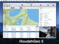
|
|
GoogleEarthTweaker
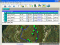
If you use Google Earth to prepare for your Geocaching trips, then you'll know that it's often difficult to find the right caches and to see which ones you already visited. This program makes it easier by preparing your GPX files for Google Earth. Ключевые слова:
Google, Earth
Скачать бесплатно! (300 Kb)
|
|
|
Picmeta PhotoTracker
Picmeta PhotoTracker automatically geotags photos based on track information from any GPS device (.gpx files). It writes GPS EXIF data to JPG, TIFF and RAW formats. Ключевые слова:
digital camera, gps, gpx, photo, geotagging
Скачать бесплатно! (5.3 Mb)
|
|
|
Final Selection
With Final Selection you can make the selection of your photos as you have always wanted! Work with your RAW, JPEG, TIFF and PSD files. Resize, geolocate, connect your camera, print, export, document, add watermarks! Ключевые слова:
photography, final, selection, pictures, images
Скачать бесплатно! (11.67 Mb)
|
|
|
Mapyx Quo
Mapyx Quo позволит вам подключить GPS к компьютеру. Просмотр информации - высота, расстояние, скорость, ETA, и т.д. .. Quo поддерживает: GE KML, GPX формате ESRI SHP, Геокэшинг, Garmin, Magellan, OziExplorer файлов и многое другое. Включает импорт со Ключевые слова:
mapyx quo, mountain rescue, digital mapping, mrew
Скачать бесплатно! (32 Mb)
|
|
|
HoudahGeo
One-stop photo geocoding for the Mac: Know where you took that photo. Write geotags to EXIF, XMP & IPTC. See your photos in Google Earth. GPS device optional. Use with iPhoto, Aperture or Lightroom Ключевые слова:
photo, image, geocode, geotag, mac
Скачать бесплатно! (17.64 Mb)
|
|
|
Advanced Points Manager
The Advanced points manager imports points to AutoCAD drawing from different data sources. OLE-DB Database, SHP (ESRI shape file), GPX (GPS eXchange format), KML (Keyhole Markup Language), GML (Geography Markup Language), TXT, CSV. Ключевые слова:
AutoCAD, import points, TXT file, SHP file, OLE-DB compliant database
Скачать бесплатно! (609 Kb)
|
|
|
Aiseesoft AnyCoord for Mac
Если вы не хотите делиться своим местоположением с другими пользователями Instagram, Facebook или другой социальной платформы, Aiseesoft AnyCoord для Mac поможет вам легко и быстро изменить свое местоположение по GPS. Ключевые слова:
Location changer, change GPS location, set virtual location
Скачать бесплатно! (71.93 Mb)
|
|
|
RoboGEO
Geotag photos from a GPS. Stamp the images or write to the EXIF headers. Export Google Maps, KML KMZ files for Google Earth, Shapefiles (SHP), AutoCAD DXF files, or Flickr. Import from tracklogs, waypoints, GPX or place names. Ключевые слова:
geocode, georeference, geotag, photo, image
Скачать бесплатно! (9.28 Mb)
|
|
|
EdiTrail
Create/Edit/Display/Management/Import/Export Trails/Routes in a simple and flexible environment divided in a data table for the management of trails and a map resulting from numerous providers, (Bing, Arcgis, Ovi, Yahoo, etc). Ключевые слова:
Trail, Route, GPS, gpx, geographical
Скачать бесплатно! (27.05 Mb)
|
|
|
OkMap
OkMap is a software that works with vectorial and raster maps that you have bought or scanned. OkMap lets you organize paths by creating waypoints, routes and tracks, and upload/download data to/from your GPS. OkMap supports GPS real-time navigation. Ключевые слова:
gps software, map software, cartographic software, poi, waypoint
Скачать бесплатно! (20.21 Mb)
|
|
Страница: 1 | 2
|
|
|
|