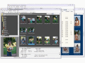
Скачать свежий бесплатный софт
geotagging
geotagging software
photo geotagging software
Мультимедия :: Редакторы Изображений
Утилиты :: Безопасность
Мультимедия :: Просмотр Изображений
Geotagging of photos with GPS track data

Picmeta PhotoTracker


Picmeta PhotoTracker automatically geotags photos based on track information from any GPS device (.gpx files). It writes GPS EXIF data to JPG, TIFF and RAW formats.

Ключевые слова:
digital camera, gps, gpx, photo, geotagging

Скачать бесплатно! (5.3 Mb)


SnipClik - Right-Click Image Utility

SnipClik


SnipClik - comment, geotag or send hundreds of photos with just one click! No need to load every photo separatelly. SnipClik is a right-click add-in that integrates directly into Windows Explorer.

Ключевые слова:
geotagging, watermark, EXIF, exif compare, resize picture

Скачать бесплатно! (1.49 Mb)


Make your images safe for sharing online

Geotag Security


Did you know that great picture from today's lunch might reveal your exact location (and we're not talking about the address on the menu)? Think before you post. Check your photos with Geotag Security and remove revealing tags before sharing online.

Ключевые слова:
eotag, geotags, geotag images, geotag photo, geotagging software

Скачать бесплатно! (2.24 Mb)


Deluxe Photo Data Toolkit for All Formats

Picture Information Extractor


The deluxe photo data toolkit. Free image browser that extracts all metadata from JPG and RAW, downloads from digital cameras, renames automatically, rotates losslessly. Geotagging with interactive map. File manager and fast viewer with slide show.

Ключевые слова:
digital camera, picture, metadata, meta, exif

Скачать бесплатно! (3.94 Mb)


Mac photo geocoding: Know where you took that

HoudahGeo


One-stop photo geocoding for the Mac: Know where you took that photo. Write geotags to EXIF, XMP & IPTC. See your photos in Google Earth. GPS device optional. Use with iPhoto, Aperture or Lightroom

Ключевые слова:
photo, image, geocode, geotag, mac

Скачать бесплатно! (17.64 Mb)


Tool for linking photos and locations

Panorado Flyer


Panorado Flyer is a simple geocoding tool for linking JPEG image files to the location where the picture was taken, using geographical coordinates. It can be lauched from the Windows Explorer's context menu.

Ключевые слова:
Photo, Find, Location, Tool, Explorer

Скачать бесплатно! (221 Kb)


Viewer/browser spec. for panoramic pictures

Panorado


Comfortable image viewer supporting panoramic pictures and HDR pictures. Instant 360-degree viewing. Navigation bar, organizer, thumbnails, full screen, slide shows, printing, picture disk creation. 14 file formats + QTVR+RAW+HDR. EXIF/IPTC support.

Ключевые слова:
Panorado, Viewer, Browser, Windows, XP

Скачать бесплатно! (2.65 Mb)


Страница: 1
Категории:
Свежий софт:
Наши проекты: