|
|
FoxPDF Image to PDF Converter
FoxPDF Image to PDF Converter is ideal software designed to convert multiple standard image formats including DWG, DXF, DWF, SHW, CDR, PSD, ICO, JPEG, JPG, JP2, CMW, J2K, JFT, SHP, IMG, IFF, PCD, PSP, PBM, EPS, TGA, WBMP, BMP, TIFF, PNG etc to PDF. Ключевые слова:
FoxPDF Image to PDF Converter, Image to PDF Converter, Create PDF from Image, Image to PDF, Convert Image to PDF
Скачать бесплатно! (13.68 Mb)
|
|

|
AnyFound Photo Recovery Free Edition
AnyFound Photo Recovery Free Edition is a secure, simple, fastest free photo recovery tool. It helps you to search, locate and recover your lost or deleted photos etc. You can preview the lost photos before you recovered it. Ключевые слова:
photo recovery, digital photo recovery, free photo recovery, recover deleted photos, anyfound photo recovery
Скачать бесплатно! (3.68 Mb)
|
|
|
AutoImager
Full-featured batch image, graphics, and photo editing and converter software for 140+ formats (JPG, JPEG2000, PDF, etc). Complete command-line operation and an entire arsenal of editing features (batch resize, flip, rotate, crop, trim and much more) Ключевые слова:
images, photos, graphic, edit, conversion
Скачать бесплатно! (17.92 Mb)
|
|

|
CtrlCAD source code C++
CtrlCAD is a 2D source code cad. It is the starting point to build your own customized drawing applications (CAD/GIS). The library is furnished in source code formats.Royalties free Ключевые слова:
vector, source code graphics, library, cad, gis
Скачать бесплатно! (2.3 Mb)
|
|

|
AvisMap Free Viewer
The free AvisMap Viewer opens most GIS/CAD and raster image file types and most ArcView, ArcExplorer, and MapInfo projects. Besides just opening and viewing files, the Viewer supports an extensive list of features. Ключевые слова:
GIS mapping software, maps, mapping, GIS, GIS SDK
Скачать бесплатно! (22.28 Mb)
|
|

|
Graph Earth
Visualize your data in 3D! Quick, easy and inexpensive. Graph Earth enables business professionals to create stunning visual representations of their data, all without the time and costs associated with a full-feature GIS. Ключевые слова:
google earth, kml, kmz, map, 3d graph
Скачать бесплатно! (469 Kb)
|
|
|
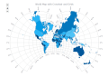
AnyMap JS Maps
AnyMap JS Maps is an advanced JavaScript-HTML5 mapping library with the ever-expanding Map Collection, which makes you able to easily create interactive maps looking great on PCs, Macs, iPhones, iPads, Androids and other devices. Highly customizable. Ключевые слова:
javascript maps, html5 maps, anychart, anymap, interactive map
Скачать бесплатно! (17.81 Mb)
|
|

|
OkMap
OkMap is a software that works with vectorial and raster maps that you have bought or scanned. OkMap lets you organize paths by creating waypoints, routes and tracks, and upload/download data to/from your GPS. OkMap supports GPS real-time navigation. Ключевые слова:
gps software, map software, cartographic software, poi, waypoint
Скачать бесплатно! (20.21 Mb)
|
|
|
CADopia Standard Edition
CADopia 17 Standard Edition is a professional drawing software for engineers, architects and other professionals who need a full-featured CAD drafting and technical drawing solution at an affordable price. Visit www. cadopia.com for more details. Ключевые слова:
corelcad, autocad, intellicad, bricscad, progecad
Скачать бесплатно! (32 Mb)
|
|

|
CADopia Professional Edition
CADopia 17 Professional is an ideal tool for engineers,architects who need a full-featured CAD software. Includes support for AutoCAD DWG, Power Trim, Pattern along a path, Advanced PDF to DWG conversion, multi-grips, many utility tools, & more. Ключевые слова:
corelcad, autocad, intellicad, bricscad, progecad
Скачать бесплатно! (32 Mb)
|
|
Страница: 1
| 2
|
|
|
|