TOPOWIN 16.03
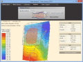
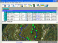
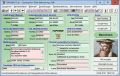
TOPOWIN is a state-wide register of the German topographic cartographies and of localities with geo references in different coordinate systems. It also is a topographic information system.
$125.00
Скачать (4.06 Mb)